Fichièr:Map of federal subjects of Russia (2022), disputed Crimea and Donbass.svg

Talha d'aquesta previsualizacion PNG per aquest fichièr SVG: 512 × 282 pixèls. Autras resolucions : 320 × 176 pixèls | 640 × 353 pixèls | 1 024 × 564 pixèls | 1 280 × 705 pixèls | 2 560 × 1 410 pixèls.
Fichièr d'origina (Fichièr SVG, resolucion de 512 × 282 pixèls, talha : 827 Ko)
| Aqueste fichièr proven de Wikimedia Commons?. Las informacions que lo concernisson son afichadas çaijós (procedura). |
,_disputed_Crimea_and_Donbass.svg?uselang=oc)

|
The boundaries on this map show the de facto situation. This is just one of several different views on the subject (see COM:NPOV). |
Descripcion
| Descripcion |
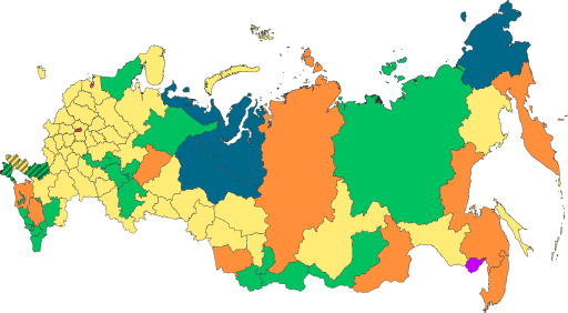
English: Copy of File:Map of federal subjects of Russia (2022).svg with disputed annexed Ukrainian territories indicated with diagonal stripes |
| Data | |
| Font |
Ce fichier est dérivé de : Map of federal subjects of Russia 2014, disputed Crimea.svg |
| Autor | Mzajac, Ltbubbas |
.svg)
Publicat jos licéncia(s)
| This map is ineligible for copyright and therefore in the public domain, because it consists entirely of information that is common property and contains no original authorship. For more information, see Commons:Threshold of originality § Maps.
|
Istoric del fichièr
Clicar sus una data e una ora per veire lo fichièr tal coma èra a aqueste moment
| Data e ora | Miniatura | Dimensions | Utilizaire | Comentari | |
|---|---|---|---|---|---|
| actual | 4 octobre de 2022 a 19.48 | | 512×282 (827 Ko) | Techso01 | Uploaded a work by Mzajac, Ltbubbas from {{derived from|Map of federal subjects of Russia (2014), disputed Crimea.svg}} with UploadWizard |
Paginas que contenon lo fichièr
La pagina çaijós compòrta aqueste imatge :
Usatge global del fichièr
Los autres wikis seguents utilizan aqueste imatge :
- Utilizacion sus ab.wikipedia.org
- Utilizacion sus ar.wikipedia.org
- Utilizacion sus ast.wikipedia.org
- Utilizacion sus be.wikipedia.org
- Utilizacion sus cs.wikipedia.org
- Utilizacion sus de.wikipedia.org
- Utilizacion sus en.wikipedia.org
- Utilizacion sus es.wikipedia.org
- Utilizacion sus fa.wikipedia.org
- Utilizacion sus fr.wikipedia.org
- Utilizacion sus is.wikipedia.org
- Utilizacion sus it.wikipedia.org
- Utilizacion sus ja.wikipedia.org
- Utilizacion sus ko.wikipedia.org
- Utilizacion sus la.wikipedia.org
- Utilizacion sus lez.wikipedia.org
- Utilizacion sus lld.wikipedia.org
- Utilizacion sus lt.wikipedia.org
- Utilizacion sus lv.wikipedia.org
- Utilizacion sus mi.wikipedia.org
- Utilizacion sus pt.wikipedia.org
- Utilizacion sus ru.wikipedia.org
- Utilizacion sus sl.wikipedia.org
- Utilizacion sus sr.wikipedia.org
- Utilizacion sus th.wikipedia.org
- Utilizacion sus tly.wikipedia.org
- Utilizacion sus tum.wikipedia.org
- Utilizacion sus uk.wikipedia.org
- Utilizacion sus uz.wikipedia.org
- Utilizacion sus vi.wikipedia.org
- Utilizacion sus vls.wikipedia.org
- Utilizacion sus zh.wikipedia.org
Veire l'utilizacion globala d'aqueste fichièr.
,_disputed_Crimea_and_Donbass.svg)
,_disputed_Crimea_and_Donbass.svg)