Fichièr:Drapeau fr département Creuse.svg

Talha d'aquesta previsualizacion PNG per aquest fichièr SVG: 800 × 530 pixèls. Autras resolucions : 320 × 212 pixèls | 640 × 424 pixèls | 1 024 × 678 pixèls | 1 280 × 848 pixèls | 2 560 × 1 696 pixèls | 1 203 × 797 pixèls.
Fichièr d'origina (Fichièr SVG, resolucion de 1 203 × 797 pixèls, talha : 184 Ko)
| Aqueste fichièr proven de Wikimedia Commons?. Las informacions que lo concernisson son afichadas çaijós (procedura). |
| Descripcion |
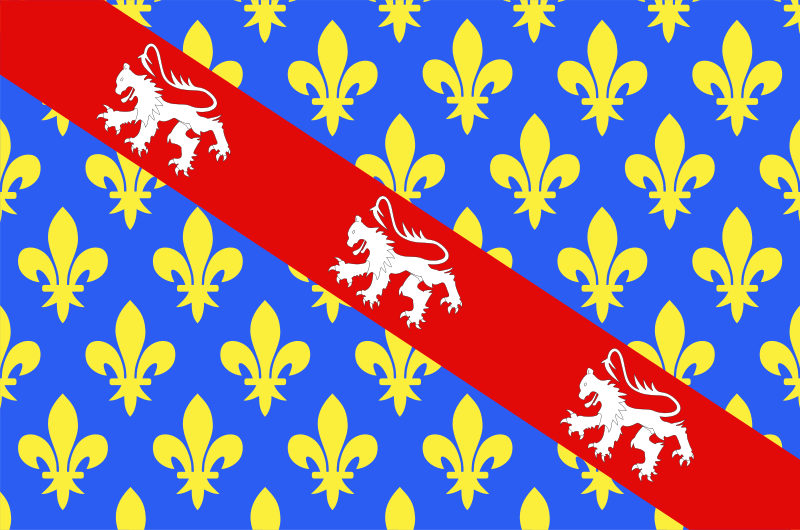
English: Flag of Creuse
Français : Drapeau du département de la Creuse
Español: Banderas de Creuse |
| Data | |
| Font | Trabalh personal |
| Autor | user:Spedona |
Ieu, autor d'aquesta òbra, publiqui jos las licéncias seguentas:

|
Avètz la permission de copiar, distribuir e modificar aqueste document segon los tèrmes de la Licéncia de documentacion liura GNU, version 1.2 o mai recenta publicada per la Free Software Foundation; sens seccions inalterablas, sens tèxte de primièra pagina de tempa e sens tèxte de darrièra pagina de tempa. Un exemplar de la licéncia es inclús dins la seccion intitulada GNU Free Documentation License. |
| Aqueste fichièr es jos licéncia Creative Commons licéncia generica atribucion-partiment a l'identic 3.0 | ||
| ||
| Aquest avís de llicència s'ha afegit a aquest fitxer d'acord amb l'actualització de la llicència GFDL. |
Aquest fitxer està llicenciat sota les llicències de Creative Commons Reconeixement - CompartirIgual 2.5 Genèrica, 2.0 Genèrica i 1.0 Genèrica.
- Sètz liure :
- de partejar – de copiar, distribuir e transmetre aquesta òbra
- d'adaptar – d'adaptar aquesta òbra
- Jos las condicions seguentas :
- atribucion – Vos cal atribuir aquesta òbra amb lo biais especificat per l'autor o lo concedent (mas pas dins un sens que suggerís que vos apròvan o qu'apròvan l'utilizacion d'aquesta òbra).
- partiment a l'identic – Se modificatz, transformatz, o vos basatz sus aquesta òbra, vos cal distribuir l'òbra resultanta jos la meteissa licéncia o una licéncia similara a aquesta.
Podètz causir la licéncia que volètz.
Istoric del fichièr
Clicar sus una data e una ora per veire lo fichièr tal coma èra a aqueste moment
| Data e ora | Miniatura | Dimensions | Utilizaire | Comentari | |
|---|---|---|---|---|---|
| actual | 29 novembre de 2007 a 17.38 | | 1 203×797 (184 Ko) | Spedona | {{Information |Description={{en|Flag of Creuse}} {{fr|Drapeau du département de la Creuse}} {{es|Banderas de Creuse}} |Source=own work |Date=28 novembre 2007 |Author=user:Spedona |Permission=see below |other_versions= - }} {{self2|GFDL|cc-by-sa-2.5, |
Paginas que contenon lo fichièr
Mai de 100 ligams de paginas cap a aqueste fichièr. La lista seguenta aficha los 100 primièrs ligams de pagina unicament cap a aqueste fichièr. Una lista completa es disponibla.
- 'Rena
- Aizenay
- Angles (Vendèa)
- Antigny
- Aubaterra
- Aubigny (Vendèa)
- Auzay
- Avrillé
- Bazoges-en-Paillers
- Bazoges-en-Pareds
- Beaufou
- Beaulieu-sous-la-Roche
- Beauvoir-sur-Mer
- Belleville-sur-Vie
- Benet
- Bessay
- Bois-de-Céné
- Bona (Charanta)
- Boufféré
- Bouillé-Courdault
- Bouin
- Boulogne
- Bourneau
- Bournezeau
- Bretignolles-sur-Mer
- Breuil-Barret
- Cezais
- Chaillé-les-Marais
- Chaillé-sous-les-Ormeaux
- Chaix
- Challans
- Chambretaud
- Champagné-les-Marais
- Chanaur
- Chantonnay
- Chasnais
- Chauché
- Chavagnes-en-Paillers
- Chavagnes-les-Redoux
- Cheffois
- Château-Guibert
- Château-d'Olonne
- Châteauneuf
- Commequiers
- Corpe
- Coëx
- Cugand
- Curzon
- Damvix
- Departament de Cruesa
- Doix
- Dompierre-sur-Yon
- Falleron
- Faymoreau
- Fontenay-le-Comte
- Fougeré
- Foussais-Payré
- Froidfond
- Givrand
- L'Aiguillon-sur-Mer
- L'Aiguillon-sur-Vie
- L'Épine
- La Barre-de-Monts
- La Bernardière
- La Boissière-de-Montaigu
- La Boissière-des-Landes
- La Bretonnière-la-Claye
- La Bruffière
- La Caillère e Saint Hilaire
- La Chaize-Giraud
- La Chaize-le-Vicomte
- La Chapelle-Achard
- La Chapelle-Hermier
- La Chapelle-Palluau
- La Chapelle-Thémer
- La Chapelle-aux-Lys
- La Châtaigneraie
- La Copechagnière
- La Couture
- La Ferrière (Vendèa)
- La Flocellière
- La Garnache
- La Gaubretière
- La Génétouze
- La Rochela
- Laudun (Anjau)
- Le Bernard
- Le Boupère
- Le Champ-Saint-Père
- Le Fenouiller
- Le Girouard
- Le Givre
- Les Brouzils
- Les Châtelliers-Châteaumur
- Les Clouzeaux
- Les Essarts
- Les Épesses
- Malaval
- Marchés
- Mesnes
Vejatz mai de ligams cap a aqueste imatge.
Usatge global del fichièr
Los autres wikis seguents utilizan aqueste imatge :
- Utilizacion sus an.wikipedia.org
- Utilizacion sus ar.wikipedia.org
- Utilizacion sus az.wikipedia.org
- Utilizacion sus bg.wikipedia.org
- Utilizacion sus ca.wikipedia.org
- Utilizacion sus ceb.wikipedia.org
- Utilizacion sus ce.wikipedia.org
- Utilizacion sus cs.wikipedia.org
- Utilizacion sus da.wikipedia.org
- Normandiet
- Savoyen
- Bourgogne
- Creuse
- Provence
- Burgund
- Roussillon
- Languedoc
- Béarn
- Fransk Flandern
- Artois
- Frankrigs provinser
- Berry
- Orléanais
- Lyonnais
- Dauphiné
- Gascogne
- Hertugdømmet Bourbonnais
- Grevskabet Nice
- Bruger:Steenth/Liste11
- Skabelon:Marche
- Skabelon:Frankrigs historiske provinser
- Anjou
- Skabelon:Lande data Creuse
- Utilizacion sus de.wikivoyage.org
- Utilizacion sus el.wikipedia.org
- Utilizacion sus en.wikipedia.org
- Creuse
- ISO 3166-2:FR
- Flags of the regions of France
- List of flags by color combination
- List of political and geographic subdivisions by total area from 5,000 to 20,000 square kilometers
- List of political and geographic subdivisions by total area (all)
- List of political and geographic subdivisions by total area from 5,000 to 7,000 square kilometers
- Template:Country data Creuse
- User:Germenfer/sandbox5
- Departmental Council of Creuse
- Utilizacion sus eo.wikipedia.org
Veire l'utilizacion globala d'aqueste fichièr.